Monday, July 29, 2013

Missoula to Walla Walla, Wa.


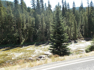
We had a very long day traveling here to Walla Walla on Thursday.  Part of the problem was again having to climb a couple of mountain passes.  However, it was on a scenic by-way- Highway 12 out of Montana, through Idaho and into Washington.  That is our rig pictured above, parked next to towering rocky canyon walls.  Our drive took us through  river canyons (as the Lochsa River Canyon).   On the left side of the road we had wonderful sightings of mountain rivers and creeks; some very shallow and clear, and others running deep with white water rapids.  While I was keeping an eye on the scenery, I was also beginning a book by Yann Martel- beatrice and virgil.  Trying thus to multi-task made for an unusual day.  Just as I found the book a bit strange, I also discovered that each section of the river we were following had strange names (which probably could be stories in themselves).  I will mention a few here:  Smoked Cedar Creek, Dead Man's Creek, Split Creek, Tumbling Falls Creek, Post Office Creek, Fire Creek- to name but a few. 
Other road signs had equally fascinating names.  We drove through the Pink House Recreation Area, as well as Heart of the Monster Site.  I just had to search for information concerning the latter one, and discovered  it is the legendary birthplace of the Nez Perce tribe.  It is their culture's creation story.  Coming into the state of Washington we found ourselves in the foothills of the Blue Mountains and the scenery changed dramatically.  Now surrounding us were low-lying hills with sparse vegetation.
 
   Our trip Thursday also took us by sites related to the Lewis and Clark Trail.  At Alpowa Summit we found interpretive signs which informed us Lewis and Clark passed through this area in May of 1806.  Lewis noted: "the lands we passed through today are quite fertile consisting of a dark rich loam".  In the picture above are vineyards, and just outside of the town of Walla Walla we saw many fields of wheat.  The wheat is ripe and waiting to be harvested.  Red combines dot the hillsides.  This area is one of the world's most productive agricultural regions; also grown here are dry peas, lentils and barley.  And since we have been parked here in Walla Walla we have enjoyed sweet onions, blueberries, melons, cherries and peaches.


Tuesday, July 23, 2013

Fort Missoula, Montana

Before I write about our trip to the fort, I wish to mention some other details about the town of Missoula.  If you are fortunate to be here over the summer season, make sure to visit the farmer's markets.  There are two of them in town on Saturdays during the summer months.  I have never seen such a variety of vegetables, fruits and bakery goods before, especially not in one small town!  A popular fruit right now, besides sweet cherries, are huckleberries.  However, we found the huckleberries to be a bit expensive.
I did buy a small bag of them.  They are about the size of wild blueberries, which makes them quite small.  After checking out the farmer's market, and buying more vegetables and breads than we needed, we went on a walking tour of Missoula's downtown.  Our first stop was Saint Xavier Catholic Church, built in 1892.  Its style of Romanesque Revival provides large interior expanses suitable for murals.
The interior was decorated by an Italian native and Jesuit lay brother, Joseph Carignano.  The murals reminded me of the religious paintings we had seen in the interior of the Sistine Chapel.  An interpretive sign outside the church notes that the artist "employs many of the devices used by early Renaissance artists as feathery trees, oval female faces, classical costumes..".   Our next stop was Missoula Art Museum where we encountered much different artwork.  MAM fosters the creation of new art and contemporary artists.
I was immediately drawn to the wooden skeleton pictured above because his dangling arms made a clacking sound as they moved up and down   His right arm is grasping a very large M-16 rifle.  The wooden sculpture was created by Jay Schmidt.  The art museum's brochure notes that "this work addresses our contemporary global culture in a frontal assault".  I usually do not care for contemporary art, but I my thinking is changing! On Monday morning we climbed Summit Mountain, its trailhead is on the campus of Montana University.  Forestry students cut switchbacks on the mountain in the early 1900s.  A concrete M was placed in1968.  After seeing the M so often as we drove around Missoula it was great to finally climb up to that concrete monolith and sit on it.  The M is 125 feet long and 100 feet wide.
 
Fort Missoula was established in 1877 in reponse to the local townspeople who wanted protection from the Montana Indian Tribes. Construction of the open fort had just begun when the first skirmish with the non-treaty Nes Perce occurred. After a couple more encounters with the Native Americans they surrendered in the Bear Paw Mountains.  The 25th Infantry arrived at Fort Missoula in 1888.  The regiment was one of four made up of black soldiers and white officers after the Civil War.  In 1896 this regiment was organized to test the military potential of bicycles.  After a 1,900 mile bike trip from Missoula to St.Louis it was decided that bicycles could never replace horses.  The fort was used during World War ll as an Alien Detention Center for non military Italian seamen, and later for Japanese-American men.  It was decommissioned in 1947.  Only three of the original buildings of the fort remain.  Pictured below is the Quartermaster's storehouse where post supplies were kept.   It has been remodeled and now houses some of the museum's galleries.  A lot of the museum, indoors and outside, has nothing to do with the fort but with the history and material culture of the region around it.  

Friday, July 19, 2013

Missoula, Montana

Our next stop was to have been Boise,Idaho.  However, the town seems to be caught in the grip of a heat wave, so we changed our plans and headed north to Missoula.  It was a beautiful but slow drive yesterday because we went over a couple mountain passes and through some gorgeous canyons.  Because of the narrow winding highway we were on (US 93) I felt that I could just about reach out and touch the jagged rocky canyon walls.  We are now parked outside of Missoula, all the campgrounds closer to town were full.
 Near where we are parked is the U.S. Forest Service campus.  In Missoula it maintains its Region Number 1 headquarters, research station and smokejumpers training center.  We had learned that a museum was located there and that we may also have a tour of the center.  We arrived a few minutes before a tour started.  Smokejumpers give the tours, which made it very interesting as our tour guide gave us his first-hand experiences with fighting forest fires.  I could not help but notice how much he loved his job, and he has been a smokejumper for 10 years.  He told us that it is necessary to have 10 years of fighting fires before taking the job, jumping from planes to fight forest fires is taught at the center.  He showed us where their parachutes are hung, in another room they are mended and placed back into their sacks.  In that room we saw jumpers at sewing machines and also at tables folding their parachutes.  It is expected of the jumpers to keep expenses down by repairing their own clothes and equipment.  On the tour we also saw their locker room.
It all reminded me of a regular fire house, with the difference being that the jumpers load into planes with parachute gear.  Their tools and food and water get tossed out of the plane after them.  Once they have landed it is necessary for them to fold and repack their parachute.  They also have to also fill their backpack with food, equipment and water.  It all comes to about 110 pounds which they have to carry.  They are not usually flown out of the fire area once the fire is contained, but must walk from several or possibly as much 100 miles out. In the museum a mannequin is dressed with the full gear of a jumper as he is about ready to head to a fire.  The forest fires out west here are usually caused by lightning.  They can be as small as 2 miles of forest, or involve many acres.  The center may receive several calls a day or there may not be any fires for a couple of weeks.  We looked at the names of the jumpers posted in the dispatch room and noticed that there are female jumpers.  The Forest Service has learned since 1944 that fire jumpers are the fastest and most efficient way to contain a forest fire, especially in remote areas where there are no roads.
 
After our visit to the museum we drove into Missoula.  The city sits astride the Jack Fork River.
 
 There is a beautiful river walk in the downtown area.  Maybe in a day or so we will hike the hill in the background.  Before starting our walk along the river we rode the carousel  at Caras Park. It is the fastest carousel we have been on, seat belts are required!  The carousel was made possible by many volunteers who carved and painted its animals. As we were leaving town we noticed a deer feeding in a residential neighborhood.   And to think that I have been looking for them in the hills behind where we are now parked!


Craters of the Moon National Monument

We visited the other half of Hell's Half Acre!  Well, the area of Craters of the Moon is a bit more than half of an acre, like about 750 thousand acres.  The land here in southeastern Idaho does have a connection, however with Hell's Half Acre as well as Yellowstone.  The Snake River Plain extends across southern Idaho in a 400 mile arc, one of the largest volcanic regions in the earth.  Its geologic features indicate that about 16 million years ago the volcanic activity began and continues today in the geysers and hot springs of Yellowstone.  Craters of the Moon represent the most recent eruptions, which occurred only 2,000 years ago.  First scientific proof of the age of that flow was found in the growth rings of the core of a limber pine, which took root after the lava cooled.  Age of the tree was estimated to be about 1,350 years old.  Oral traditions of Native Americans also tell of a time when the lava flowed.
The eruption at Craters of the Moon was similar to Hell's Half Acre- vast amounts of lava issued not from one volcano, but from a series of deep fissures known collectively as the Great Rift.  However, here the eruptions were of a more moderate strength, strong enough to throw up cinders into the air, and these cinders built up into fairly large cones.  John and I climbed Inferno Cone to view a row of cinder cones which make up a part of the Great Rift.  The tallest cone in the monument, Big Cinder Butte, is 700 feet high.
As we found at Hell's Half Acre, the lava fields do eventually sprout life, called cinder gardens.  Lichen breaks the rock down into soil, and soil is also brought in by the wind.  Desert-tolerant plants take root and life begins.  We saw cones dotted with the white-colored dwarf buckwheat, and, on one side of  Inferno Cone, we found a patch of blazing star.  It reminded me of Cinderella sitting among ashes.  Most of the plants grow with such regular spacing that we wondered whether someone planted them.  However, we later learned from the park's brochures, that regular spacing occurs because each plant competes for water through their extensive root system.  That spacing is needed for survival.
 
Unfortunately we did not catch the plant at its prettiest moment, its blooms open only at night.  If we thought finding a pretty flower in this barren hot land was strange, how about finding a patch of snow?  We climbed a splatter cone (cones made by clots of lava paste instead of cinders) and peered into its vent.
That is a patch of snow!  Craters of the Moon certainly had many surprises for us.  It is an interesting land, but not one where anyone would choose to live.  In the past Native Americans and pioneers would only pass through it, not choosing to live there because of the lava terrain and lack of water.  Astronauts visited it thinking that the harsh alien environment would give them a feel for the geologic features of the moon.   I will conclude this with one final picture.  In my last posting I had a picture of ropey coil of lava, pictured below is a better picture of that type of lava flow.  In the background are fragments of a crater wall.


Wednesday, July 17, 2013

Arco, Idaho

It has been quite warm here in Idaho, so museums have been our better bet.  Before leaving Idaho Falls, we spent a good part of Monday at the Museum of Idaho.  It has an interesting temporary exhibit with the title "Guitar: The Instrument that Rocked the World".  Considering that 3 million guitars are sold yearly, more than all the other instruments combined, it would seem that there would be a lot of interest in this exhibit of everything having to do guitars.  It was a busy place when we there.  On display is an 8-neck guitar built by the National Guitar Museum, which has been played by 8 musicians- it is called the Rock Ock.  Also in this exhibit is the world's largest playable guitar.  It is 43.5 feet long and 16 feet wide.  It has been certified by Guiness Book of World Records.  A fun part of this exhibit features hands-on experiences with the science of sound and the design and engineering of the guitar.
On Tuesday we moved our home to Arco, the first town to be powered by atomic energy.  Before parking our home we stopped at a building outside of the town where the peaceful use of nuclear power was born. 
On Dec.20,1951 EBR-1 (Experimental Breeder Reactor) became the first power plant in the world to produce usable electricity using atomic energy.  The best way I have here to explain how it all happened is to quote from an interpretive sign in the museum.  "In the core reactor speeding neutrons smashed into the nuclei of uranium and plutonium, splitting them in half.  The result: release of energy- and more neutrons.  The heat generated electricity."  That is about all I can tell you, it is much more involved; especially the details of how the irradiated elements and subassemblies had to be handled.  Pictured below is the turbine and generator, which in 1951, lit 4 light bulbs hanging nearby. When they lit up it was proven that atomic energy had been harnessed for electricity.  On a chalk board in this area are the signatures of the crew who made it happen.  The bright light at the end of the generator is where the light bulbs are hanging.
Another important area of Idaho is also located near Arco.  Craters of the Moon will be in my next posting.

Monday, July 15, 2013

Hell's Half Acre

After we parked our home Saturday afternoon we drove to the downtown area for supper.  While we were eating I happened to glance out the window and see a small portion of the falls for which the town is named.  The falls on the Snake River are long and low, they stretch for 1,200 feet. After supper we walked  in the beautiful city park which runs along the river and falls. 

John reads all the tour books when we arrive into a new area, and he happened to find in an Idaho " State Adventure Guide" a small paragraph about Hell's Half Acre.  When he questioned locals as to how to find the place many had to admit that they knew nothing about it.  Understandably so, for it is in a highway rest area just outside of town, who stops at a rest area when they are close to home?  As you can tell by the above picture, we did find the place.  It is a 4,100 -year-old lava flow with paved walkways and signs describing the unique ecosystem.  The interpretive signs stressed that this was not a volcano but a quiet lava flow.  Molten rock forced its way through fissures in the earth's crust and cooled into lava. 
Evidence proving it was a quiet flow have been found in the ropey coils of lava found at this site as well as in the presence of basalt rock.  The surface of basalt shrinks when it is cooling and forms deep cracks as well as columnar joints.  Along the trail we also saw many other interesting features of the fluid flow- from caves, tunnels, deep fissures, as well as large depressions in the earth
One thousand years ago the lava solidified, and wind-blown soil covered the rock areas.  That explains the presence of vegetation now in this lava flow.  Sagebrush and juniper trees offer shade and food to the big game animals who visit this area.  According to information along the trail, sagebrush is a highly nutritious food source containing four times the protein of other range vegetation.  Unfortunately 90% of "sagebrush sea" that once covered the American West has been converted to crop land or urban development.  Sagebrush is pictured in the foreground of the picture below.  Its foliage feels very soft, and we learned that it is very digestible for the animals to eat.  We also discovered that it has a wonderful smell.  It had recently rained and there was a gentle breeze blowing when we were there, all of which probably helped to make the odor quite noticeable.  Despite the nice breeze, however, it was quite warm when we walked the trail, and with the rugged landscape we could understand why it has been called Hell's Half Acre. 


Following the Snake River into Idaho

This posting will involve a bit of this and that as I wrap up our visit to Grand Teton National Park and move on to Idaho Falls Idaho, where we are presently parked.  On Friday of this past week we drove to the southern entrance of the park where Jackson is located.  Until I learned better, I was referring to the town as Jackson Hole.  However, Jackson Hole Valley is the area encompassing the town of Jackson.  Before arriving in Jackson we drove up Signal Mountain to view the valley below.
The lake pictured above is Jackson Lake.  It is a dammed up lake of the Snake River.  We wondered how Signal Mountain got its name, thinking it had to do with Native Americans and their smoke signals.  However, the first thing we noticed at the summit was a large building and a tower filled with antennas next to it.  Strange that we did not even consider Signal Mountain having any connection with the past fifty years!  One more item before leaving the Tetons.  The range is comprised of three mountains;  the South, Middle and Grand.  Shoshone Indians called them "Teewinot" meaning pinnacles.  Canadian Frenchmen called them "Le Trois Tetons, or the three breasts.
Pictured above is a street in the town of Jackson.  In the lower right-hand corner is an arch of elk antlers.  They have been gates to the Jackson Town Square since 1960.  Elk National Refuge is located just outside of the town, and 7,500 elk winter there yearly.  The bulls shed their antlers in the spring, and local Boy Scouts pick them up in May.  They are then sold in a public auction.  The town is a supply point for ranchers and tourists.  Besides the usual tourist shops there are also up-scale clothing and jewelry stores as well as art galleries.  Outside one art gallery we saw some interesting life-like sculptures.
Pictured above is George Washington and Albert Einstein.  In other benches near them are Mark Twain and Abraham Lincoln.  On Saturday we drove further west from Wyoming into Idaho, following the Snake River.  We stopped at a  rest area and discovered that it overlooked a canyon through which the river flowed.   That scene is pictured below.  One thing we noticed driving further into Idaho are many  fields of potatoes.  Currently they are in bloom with white flowers. That evening we parked our rig in Idaho Falls.

Sunday, July 14, 2013

Grand Teton National Park


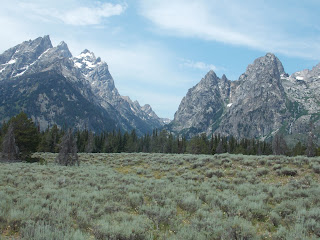
There are no foot hills in this park to obstruct our view of the Teton Range.  We could easily see them from our home in this park, so being away from phone or internet was not all that bad.  The mountains rise up sharply from Jackson Hole Valley.  One of our first stops in the park was to get a close view of the mountains.  Sagebrush flats are in the foreground, they give the landscape a silvery gray-green color.  Grand Teton is the tallest in the mountain range and is easily identified by its jagged peaks.
 The Teton Range rank among the youngest in the world.  However, geologic forces have been at work in this area for millions of years.  Beginning 10 million years ago movement on the Teton fault generated massive earthquakes causing the mountains to rise while the valley floor dropped.  Starting two million years ago massive glaciers flowed south from Yellowstone, eroding the mountains.  More recent glaciers have receded 15 to 25 per cent in the past 40 years.  The alpine glaciers sculpted the jagged Teton skyline and moraines ( masses of rocks and sand) have dammed beautiful lakes as Jenny Lake.  We took one of the more popular trails in the park along that lake, where we were able to enjoy additional wonderful vistas of the Tetons.  South Jenny Lake is at the bottom of Cascade Canyon, which is located in the split of the mountain range in the picture above.
 The trail took us steadily upward, about 21/2 miles to Hidden Falls.  It was a bit strenuous, like our hike Sunday, with some rock scrambling and took us a couple of hours.  From the trail we also had a great view of Moose Lake.  John remembers, when we were here years ago, that there were moose grazing by the lake.  None could be seen when we were there.
Hidden Falls was worth all the pain of getting there!  As we neared the falls we could hear them, but they remained hidden from our sight until we were right in front of them- hence the name Hidden Falls. 
 We were hot and tired, and the mist from the falls felt good.  Signs near the falls reminded us that this was a place to “be bear aware”.   Many people, us including, haul out snacks once they reach the falls, and also near the falls are many berry bushes.  Both probably draw bears to that area.   Going down was a bit easier and took us less than an hour.  As we neared the end of the trail we saw one mule deer feeding a short distance from us.  I really hate it when wildlife refuse to pose for me!  Many of my pictures are of their backsides.

Saturday, July 13, 2013

Yellowstone National Park- Part Two


From Norris Geyser Basin we drove west to Canyon Village, after a brief stop for supper.  Here we had spectacular views of the Grand Canyon of the Yellowstone River and its waterfalls. Yellowstone Park received its name because of the color of the walls of the canyon.   The canyon once slid through an ancient volcanic basin; hot water eroded the rock walls of lava and rhyolite.  The canyon is still being eroded today by the Yellowstone River.  An interpretive sign near a lookout point over the canyon noted that it is forever growing wider,deeper and longer. 
 
On North Rim Drive we stopped at an overlook and could see the upper falls off in the distance.  The lookout point also had a vista of the lower falls, and from this point it is possible to take walkways along the canyon’s rim.  It was along one of those walkways where we were able to get some wonderful views of the lower falls.  Most interesting to us was the strip of dark green flowing down the middle of the falls and a patch of snow off to its side.  The green color is most likely because of algae present in the river
   On our way back home we drove a good distance along the Yellowstone River, through forests of lodgepole pine.  One particular section of the park was quite burned, only charred stumps of trees could be seen.  It was here where we saw a large elk buck feeding.  He probably was enjoying the new vegetation springing up among the many dead trees which were strewn on the ground around him. 
 
That was pretty much our day in Yellowstone, a place of rugged mountains and volcanic plateaus.  I think that if I take away any particular memory of the park it would be of its many geysers and hot springs.  We occasionally would see, just while driving along a mountain stream, evidence of that activity by a puff of steam arising out of the water.  In the canyons and rivers of Yellowstone there are steam vents which continually allow heat, hot gases and hot water to escape. After awhile we got use to seeing large patches of denuded white and black rock, evidence of the presence of ancient lava flows and hydrothermal activity.

Yellowstone National Park


Sorry that I have stopped posting here for several days, but our latest campground was a bit removed from civilization.  We should have put in our reservations for the Grand Teton/Yellowstone area, but we failed to do that.  One would think we would wise up after the several times we have been here over the years!  This has gotten to be one of the busier national parks during the summertime.  We did find a place to park in Grand Teton National Park-problem is that it a bit too remote to receive any telephone or internet communication.  On our first day in this area we drove north from Grand Teton National Park to Yellowstone, a distance close to about 60 miles.  It is probably necessary here for me to explain what Yellowstone Park is all about- and I will use the park’s brochure to explain the peculiarities of the park.  About two million years ago, then 1.3 million years ago, and again 640,000 years ago the Yellowstone Volcano erupted and ripped open miles of mountainous terrain, leaving behind a massive caldera that stretches 45 miles from rim to rim.  The magmatic heat powering those eruptions still to this day powers the park’s geysers.   Yellowstone has a total of 10,000 of them, of which Old Faithful geyser is the most famous. While waiting on Old Faithful we took a walk along the boardwalk to view other geysers in the area..  The picture below should give you an idea as to what one of the numerous hydrothermal areas of the park looks like.  Not all of the hot spots are geysers, but just hot bubbling water or mud.  As I will explain later, minerals in the rock and microorganisms create a palette of colors from very bright orange to hues of green and blue.
 
 Well, Old Faithful is not all that faithful anymore.  I can remember coming here about twenty-five years ago and then we could count on it erupting about every hour.  Now its eruption varies from 40 to 126 minutes.  The visitor’s center near that geyser posts a schedule as to when it will erupt.  While we were there it was expected to erupt at 2:10 PM.  It was not until about 2:30 that it began erupting into its full mode.  As the time slowly passed while we were waiting on the geyser I kept thinking that surely the crowd would dissipate, but everyone stayed.  Babies cried and older children became fussy under the hot sun, but no one left.  When Old Faithful finally fully erupted there was silence among the crowd.  I can never get tired of seeing it, the waiting and wondering whether it will happen is part of the charm of Old Faithful.
 Another place where we stopped in the park is Norris Geyser Basin.  The basin is among the park’s hottest most acidic hydrothermal area.  We hiked around its Porcelain Basin and again saw a mixture of geysers, hot springs, fumaroles and mudpots.   The hot pools of warm water vary in color from azure to turquoise, prettiest of these is Crackling Lake.  It did seem to have a crackling sound,  but I thought that maybe its shimmering appearance gave off an illusion of a crackling sound.  Either way, what a beautiful lake!
 Microorganisms (thermoacidophiles) who love both the acidic and hot pools color the landscape.  Perhaps the picture below can capture some of the beauty of Norris Basin.  I will write more on our day in Yellowstone in my next posting. 

Monday, July 8, 2013

Ogden, Utah

There are no Lutheran churches in Brigham,  it does have one Methodist church which we considered attending Sunday morning.  John, however, pointed out that there is a scenic canyon and waterfalls in Ogden which he wanted to see.  Coincidentally, Ascension Lutheran church is located in Ogden and we were quite blessed to have attended church services there.  Pastor Muter had some very interesting thoughts on Galatians 6:7-16, both in his sermon and Bible study afterwards.  In the epistle Paul talks about the fact that with Christ's death we have a new spin on the law, it becomes the seed of the gospel.  Now there should no longer be rigid laws and regulations within in the church, for Christ has made all things new.  The law of God brings the love of God to us and should build up the spirit of gentleness within us as we live in relationship with each other.  The kingdom of God is within us as we live out our lives- if we do not get it right there is always God's grace and love.  They were good words to hear once again, and I was thankful we made the effort to get to Ogden for church.  After Bible class the pastor spoke with John and I about his ministry at Ascension- what  was interesting to us was that the church has a drive- through prayer window!
 
The town of Ogden can be seen in the background of the picture above, I snapped it as we were starting to hike up the Waterfall Canyon Trail.  This is a great town to live in if you want to be active outdoors the year around.  Eleven national park's are less than a day's drive from the city.  During the winter season there are three major ski resorts within 25 minutes.  The Waterfall Canyon Trail is a favorite hike for many of the locals.  It is a strenuous hike with a lot of rock scrambling.  The trail is 1.2 miles one way- does not sound like much, but it took us several hours going up and coming back down.
 It was necessary for us to stop and rest at intervals- raspberry bushes filled with ripe fruit and small streams refreshed us on the hot journey upward.  As a side note here, we have found wonderful fruit orchards near Brigham and have been feasting also on sweet cherries and apricots.  Back to the trail- many of the young adults we met on its path were friendly and encouraging to us.  I did not realize how much I missed having young people around us, which is one problem for me with our gypsy life-style!  We did make it to the top, the hike was worth it, once we saw the 200-foot waterfall.
It is difficult to see the waterfall in the picture above as it is spread out in several streams over the width of the cliff.  It felt just great to sit on the rocks below it and let its mist blow over us.  There were also some beautiful wildflowers in this area,  pictured below is a patch of penstemons. 
On our way down we noticed a man coming up the trail carrying what I thought looked like a fat walking stick.  I was glad that I asked him what it was, for he promptly played us some toe-tapping music.
It is a didgeridoo,  a wind instrument from Australia.  The young man said that he wanted to find how how it would sound when he played it by the cliffs and waterfall.  I was tempted to follow him back up to hear some more of the music but we had another waterfall to see in Ogden.   A young man we had spoken to on the trail gave us directions on how to find it.  If we understood him correctly, it is a man-made falls created by diverting the Ogden River up a high cliff through a pipe which hangs over the highway.  There is certainly a lot to see and do in this part of Utah, but tomorrow we are moving on.